


I bought it for my emergency backpack as one of the items in case of a possible blackout. It's been a long time since I held such a map in my hand. All the markings are clear, it's compact when folded, overall it's okay. I prefer GPS on my phone, but it's worth having such a map.
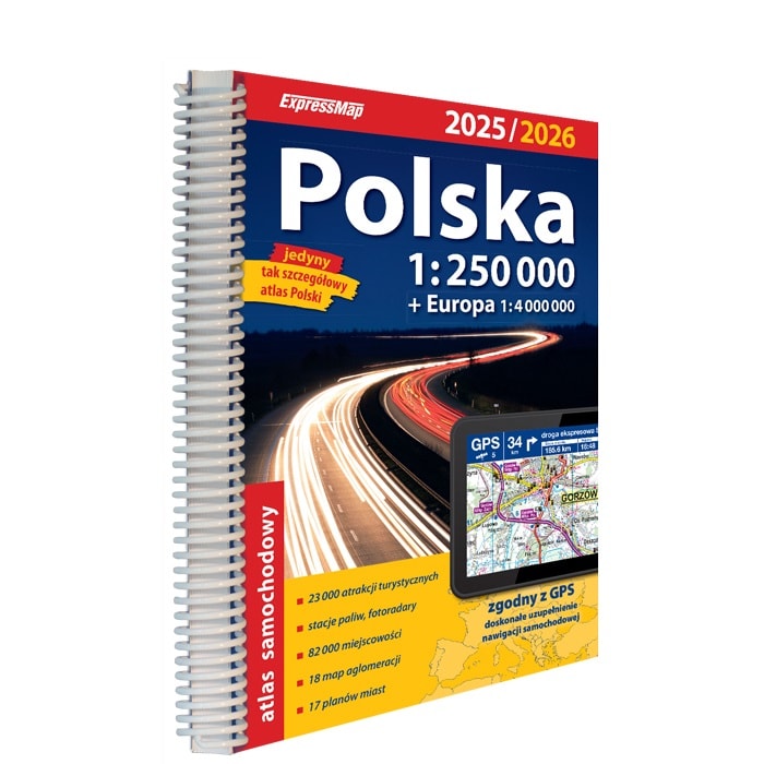
Poland Road Atlas 1:250000

Shipping: Immediately
€27.98
Manufacturer's suggested price
€37.30
Top
- description
- technical data
- Reviews
- Goes Well With

€27.98

Poland Road Atlas 1:250000
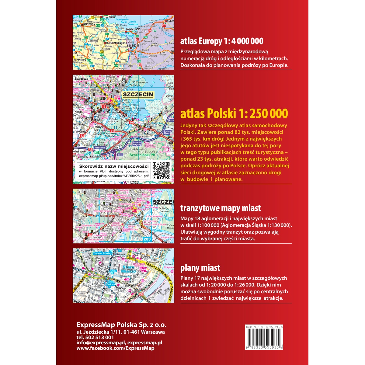
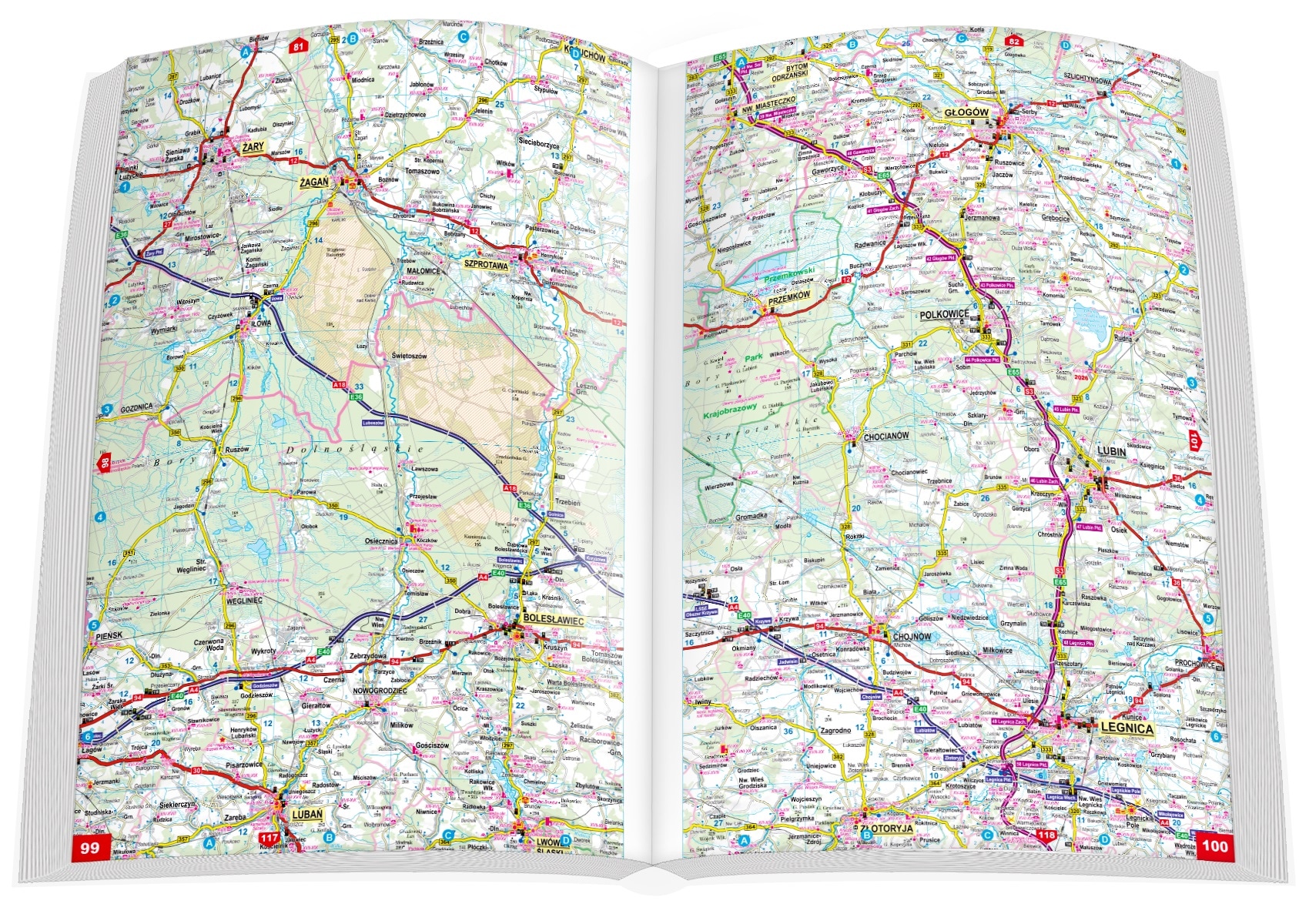
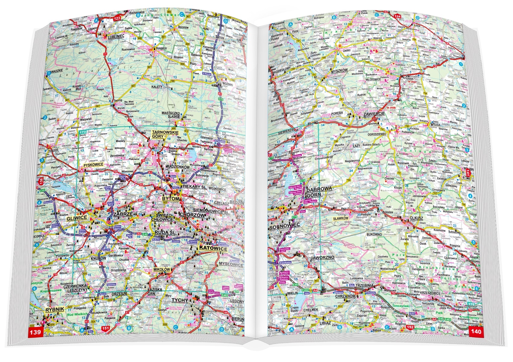
A softcover road atlas of Poland featuring road maps at a scale of 1:250000. Presents the road network as updated for 2025, including both roads under construction and those planned for the future. The atlas details 365000 kilometers of roads and 82000 towns. Designed for professional drivers yet equally practical for motorized tourists, with clearly marked tourist attractions.


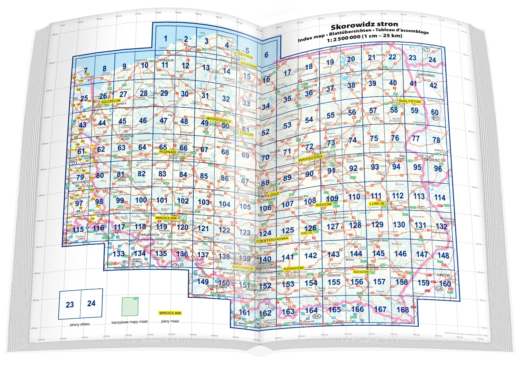
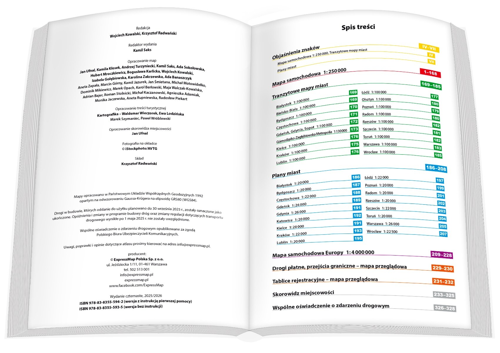
Contents
The Atlas features:
- Road network status projected for 2025, including routes under construction and those planned for future development,
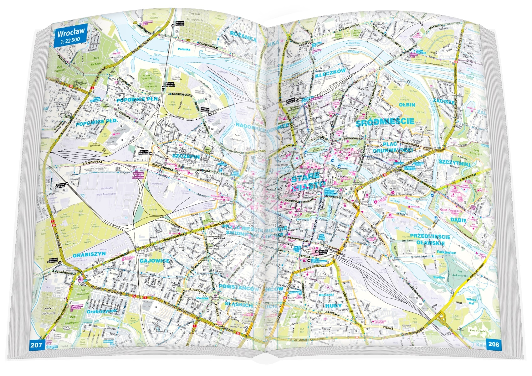
- 17 detailed city maps,
- Comprehensive overview map of major Polish roadways,
- Highways and expressways listed with interchange names,
- Map coverage of e-TOLL routes and toll highways,
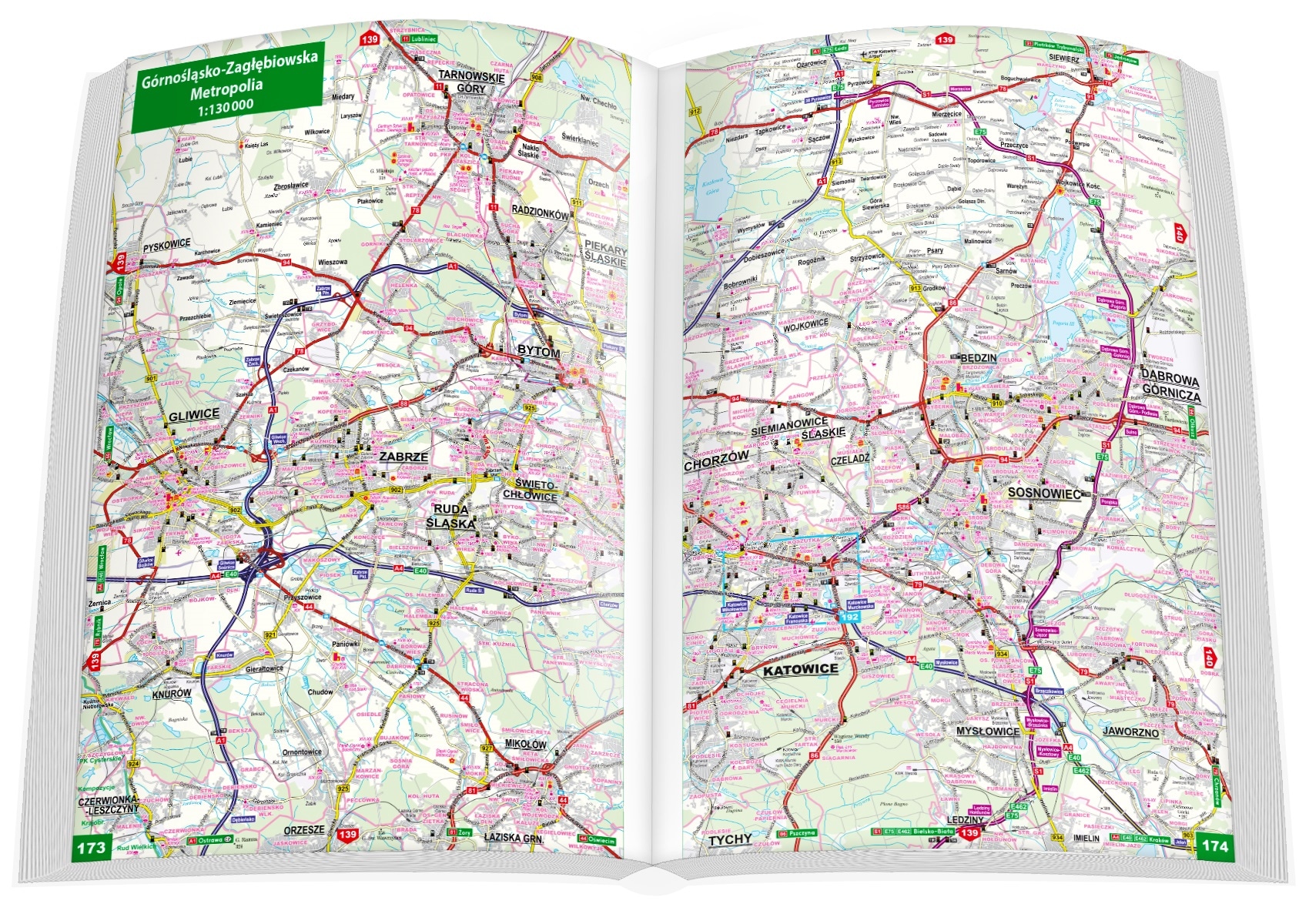
- 18 through-route city maps,
- Intercity road distance data,
- Locations of fixed speed cameras and average speed checkpoints,
- Both national and international highway numbering,
- Over 23,000 tourist sites marked,
- Selected locations known for tourist attractions,
- Demarcation of national and landscape park borders,
- Information on chosen hotels and motels,
- 3D topographic relief representation,
- Detailed vehicle registration plate map,
- List of fuel stations, organized by network affiliation,
- Stations for charging electric vehicles along highways and expressways,
- Index featuring over 71,000 settlements, annotated by voivodeship and county, available as a downloadable PDF,
- Europe-wide Atlas at a 1:4,000,000 scale,
- Standard road incident report form included.
| Scale | 1:250000 |
|---|---|
| Edition language | Polish |
| Number of pages | 336 |
| Year of publication | 2025 |
| Map type | car |
| EAN | 9788383555935 |
| Manufacturer code | Polska.250_atl_ATL-_PLg25 |
| Brand | ExpressMap |
| EAN |
Reviews with photos
Review summary
Automatically prepared based on reviews
Number of reviews: 2
-
-
The map is clear, easy to navigate, and you don't have to rely only on your phone or GPS. It's nice to have something like this on hand, especially when you're going to less known places.
No reviews
